At the southwest gateway into Okotoks, a new neighbourhood takes shape – where distinct natural features meet a close-knit sense of place, creating a memorable first impression for all who arrive.
At the southwest gateway into Okotoks, this new community will seamlessly blend the natural landscape with parks and amenities, creating a destination for all.
Hopewell Residential
Southwest Okotoks Neighbourhood Area Structure Plan
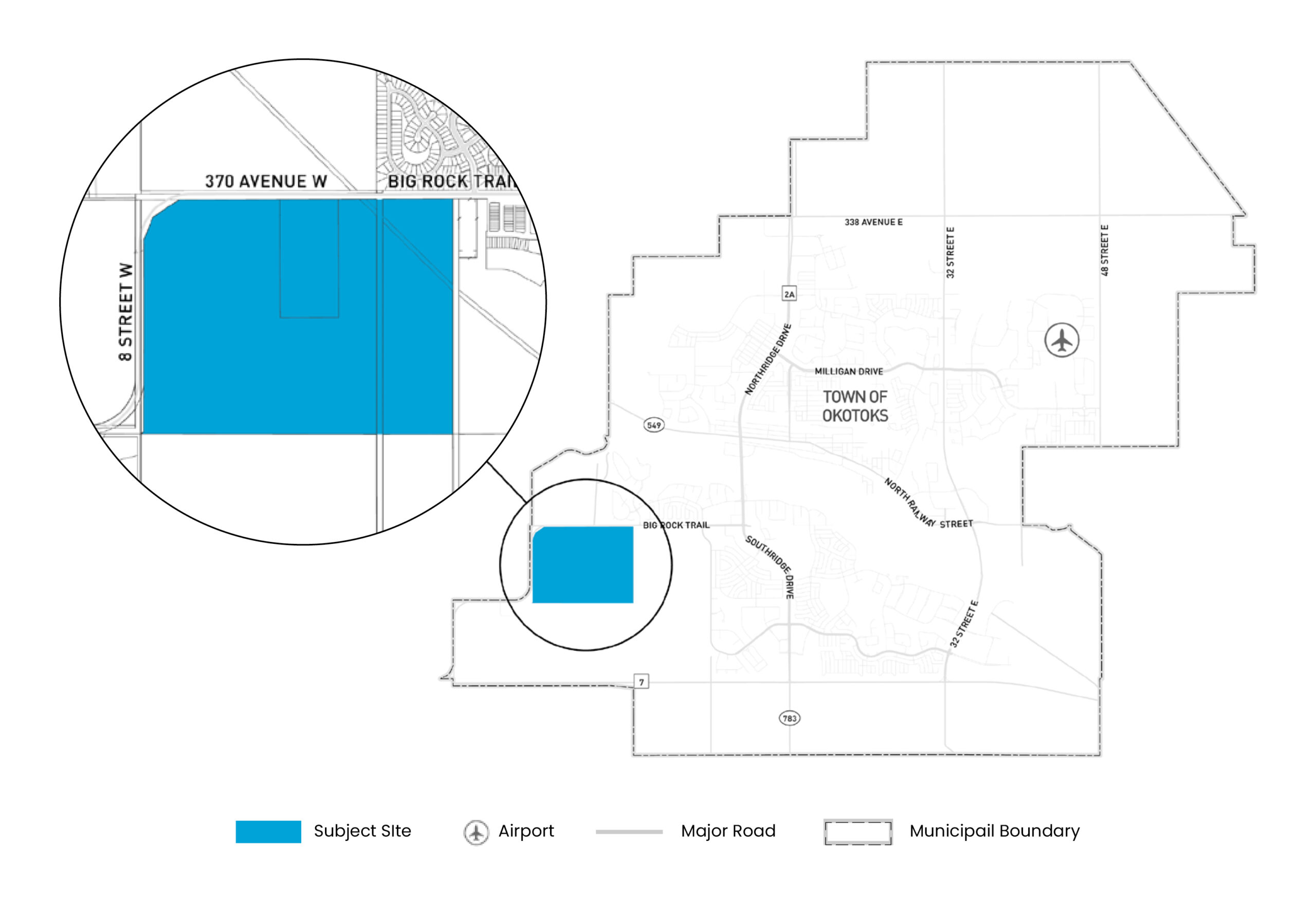
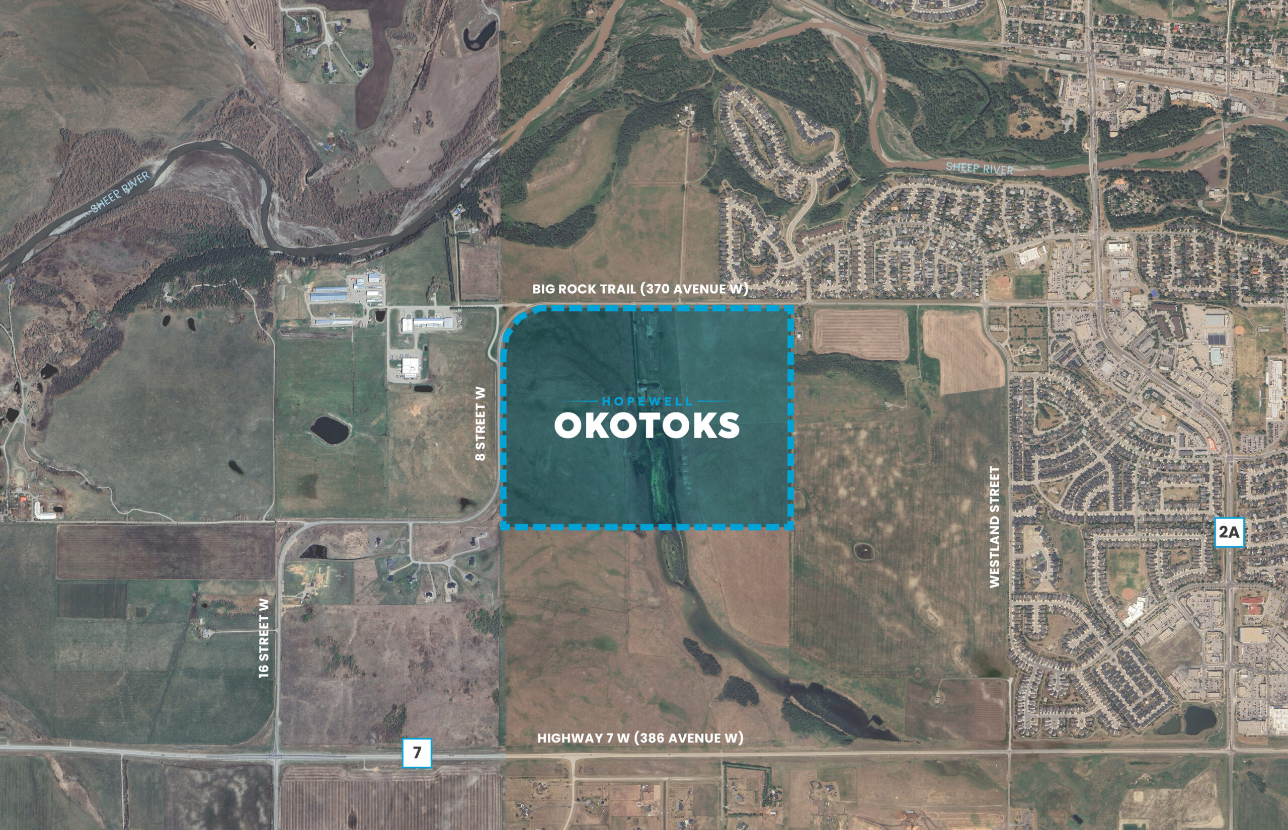
Hopewell Residential is pursuing the development of a new neighbourhood in Southwest Okotoks, through the drafting and approval of a Neighbourhood Area Structure Plan (NASP). An NASP is a statutory plan that will guide the development of approximately 220 acres (89 hectares) of land in southwest Okotoks. The plan area is southwest of the existing neighbourhood of Sheep River Ridge and west of the developing neighbourhood of Tillotson.
At full build-out, anticipated to take place over a 10 to 15-year period, the plan area will form a new neighbourhood containing:
This complete community will be thoughtfully designed to celebrate the natural landscape and provide services and amenities for not only future residents of this neighbourhood but also the larger Okotoks community.
Planning Framework
The Government of Alberta Municipal Government Act (MGA) provides the basis for planning processes, documents, policies in Alberta, which provide guidance for future development at various scales and level of detail.
In general, higher order plans cover a larger geographical area and provide broader development direction and policies, while lower order plans and applications cover smaller areas and provide more specific details.
This NASP will advance the planning work completed through the West Okotoks Area Structure Plan, adopted on April 28, 2020, to facilitate additional technical analysis and provide a greater level of detail for this neighbourhood.

What is a Neigbourhood
Area Structure Plan?
A Neighbourhood Area Structure Plan (NASP) is a statutory plan that, upon approval by the Town of Okotoks Council, will provide a detailed framework to guide the future development. The NASP shall address the following:
- Community vision and guiding principles;
- Policy and regulatory framework;
- Plan area conditions, opportunities and constraints;
- Surrounding area conditions, opportunities and constraints;
- Residential land uses, density and projected population;
- Non-residential land uses, employment density & projected jobs;
- Open space network and conceptual programming;
- Pedestrian and vehicular circulation;
- Water, Sanitary and Stormwater utility servicing systems; and,
- Phasing of development within plan area.
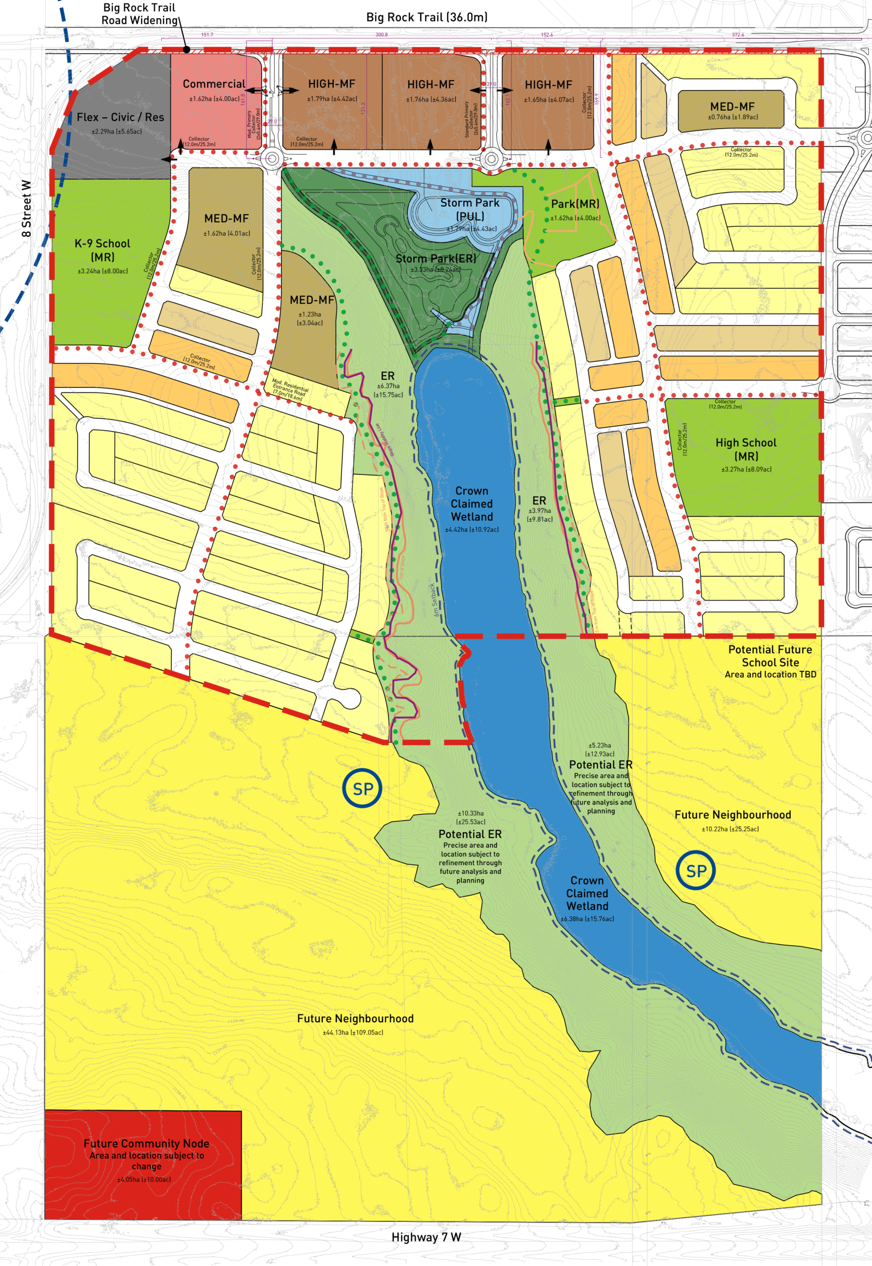
Land Use Concept
A Land Use Concept illustrates the general location of proposed land uses, streets and pathways, and open space areas. It provides a framework for how a community will be developed over time. The land use concept is informed by completed baseline studies, technical evaluation and feedback and review provided by the Town of Okotoks and other interest holders.

The preparation of the NASP is being sponsored and led by Hopewell Residential in partnership with the plan area landowners.
NASP Project Team


SW Okotoks Neighbourhood Area Structure Plan
Looking to stay updated on the Neighbourhood Area Structure Plan?
Sign-up to the mailing list and receieve updates on the NASP process. Hopewell and the project team are committed to working with the community to keep residents informed about the project, respond to questions and collect comments.